

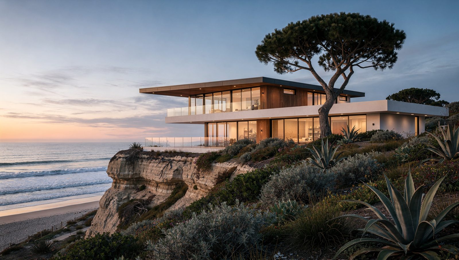
3D Rendering in Encinitas for Architects and Homeowners
I am a licensed California architect producing photoreal 3D rendering for Encinitas projects. Encinitas is a low-slung beach town that guards its scale. Between the 30-foot height limit, Proposition A’s voter-approval requirement for upzoning, and a Coastal Commission that watches the bluff line, the design question here is almost never “how big” — it is “how do we get the volume we need without reading as a box that towers over the street.” Accurate massing studies answer that before a hearing does.
Rendering & Visualization Services for Encinitas
For Encinitas projects, I cover the full pipeline:
- 3D architectural rendering — exterior, interior, aerial, and twilight views accurate to your spec
- Height-limit and bulk studies rendered against the real streetscape, so a design review hearing sees scale honestly
- 3D modeling from your 2D drawings so a survey and schematic set become a working model
- fly-through animation for presentations and marketing
- VR/AR architectural presentations on a Meta headset, brought on site in Encinitas
Local Landmarks & Project Context Near Encinitas
Encinitas runs from Leucadia and the Coast Highway 101 corridor down through downtown, Moonlight Beach and Swami’s to Cardiff-by-the-Sea, with Olivenhain’s larger semi-rural lots inland and the Self-Realization Fellowship gold domes on the bluff. Lot character changes block by block — a 40-foot Leucadia beach lot and a two-acre Olivenhain parcel are different design problems entirely. I work regularly in the 92024 and 92007 zips and in neighbouring Cardiff-by-the-Sea, Leucadia, Olivenhain, Solana Beach and Del Mar. For more on photoreal coastal work, see 3D architectural rendering in San Diego.
Building Under a 30-Foot Ceiling
Encinitas’s height limit is the single constraint that shapes most projects here, and it is the one clients misjudge most often. I model the true finished grade from your survey, apply the measurement method the city actually uses, and render the proposed home against the neighbouring roofs so you can see the result rather than argue about it. Where a design pushes the envelope, a massing study at LOD 200 costs a fraction of a redesign and tells you in days whether the volume works. For sloping Leucadia and Cardiff lots, that same model tests how the split-level steps down the site and where the daylight actually lands.
Bluff Setbacks and Coastal Review
West of the 101 the Coastal Commission and the city’s bluff-edge setbacks decide what can be built and where. I model the bluff edge from your geotechnical survey rather than from a contour guess, place the structure against the required setback line, and render the view both from the deck and from the beach below — the two viewpoints a coastal hearing cares about. That gives your coastal consultant an exhibit instead of a description.
Why Encinitas Architects Work With a Licensed Architect
I am a licensed California architect with two decades of software engineering behind me and design credits in Shady Canyon, a $5M-plus gated community. I read your construction documents the way your plan checker will, I automate the slow parts of BIM, and I deliver real headset VR rather than a web tour. Encinitas is about 25 miles and roughly 30 minutes up I-5 from my San Diego base, and I travel there for on-site VR and presentations. More about the architect behind the work.
What to Expect
You send drawings and, where views or height matter, your survey. I confirm scope and the views you need, build the model, and send a first pass. You review, I refine, and you get final images, animation, BIM outputs, or a VR file ready for a client or a hearing. One architect, no handoffs. Starting from 2D? Here is how I handle converting 2D drawings into a 3D model.
Ready to Start a Project in Encinitas?
Send me your drawings and tell me whether height limits or the bluff edge are driving the design. I will tell you what I can deliver and when.
Start a Project or call 949-291-5027.
Frequently Asked Questions About Rendering in Encinitas
How far is Encinitas from your studio?
About 25 miles and roughly 30 minutes up I-5 from my San Diego base. Modeling and rendering are handled remotely, and I travel to Encinitas for on-site VR presentations and design meetings.
Can you show whether a design clears the 30-foot height limit?
Yes. I model finished grade from your survey and apply the city’s measurement method, then render the home against the neighbouring roofline so the height reads honestly to a reviewer rather than being argued in the abstract.
Do you work on Leucadia and Cardiff bluff lots?
Yes. Bluff-edge setbacks and coastal review shape those projects, so I model the bluff from your geotechnical survey and render the view from the deck and from the beach below.
Can you handle small infill beach lots as well as Olivenhain estates?
Yes. A 40-foot beach lot and a two-acre Olivenhain parcel are different problems, but both start the same way: your drawings, your survey, and an agreed level of detail before I model anything.
What do you need to start an Encinitas project?
Your drawings in any format — AutoCAD, Revit, SketchUp or PDF — plus a survey if height or the bluff edge matters, and the views you need. I confirm scope and a delivery date before starting.
Start Your Encinitas Project
Encinitas projects live or die on scale and setback. Send me your drawings and your survey and I will tell you what the volume actually looks like from the street.
Ready to Start a Project in Encinitas?
Tell me about your lot, your height constraints, and your timeline. I will scope the work and give you a delivery date.
Start a Project or call 949-291-5027.
Thorpe Studios
San Diego, CA
Phone: 949-291-5027